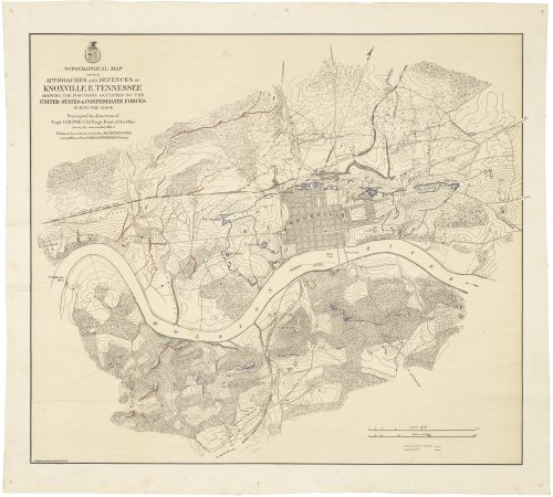
Striking bird’s-eye view of the western theatre of the Civil War
Drawn from nature and lith. by John Bachmann, [at top:] Panorama of the Seat of War. [and at bottom:] BIRDS EYE VIEW OF KENTUCKY AND TENNESSEE SHOWING CAIRO AND PART OF THE SOUTHERN STATES. New York: John Bachmann, 1861 [but 1862].
Four-stone lithograph, 16 ¼”h x 28 ¼”w plus title and margins. Minor spotting and soiling in margins, tiny chip to lower-left corner reinstated, and some hinge residue on verso. Better than very good, and far better than usual for Bachmann’s Civil War views.
$4,250.00
In stock
John Bachmann’s striking bird’s-eye view of the western theatre of the Civil War, issued to capitalize on patriotic enthusiasm in the early months of the conflict.
Though popular imagination tends to locate the events of the Civil War in a vast arc connecting Gettysburg, the Shenandoah Valley, and Atlanta, much of the most important action took place in the Mississippi River watershed. This was a logical consequence of the Union’s so-called “Anaconda Plan”, which was designed to strangle the South by blockading its Atlantic and Gulf Coast ports and gaining control of the Mississippi. The former would block the Confederacy’s cotton trade with Europe and access to its armaments; the latter would split Louisiana, Arkansas and Texas from the rest of the Confederacy.
For this view of the western theatre of war, John Bachmann employed a panoramic, or “bird’s-eye view” perspective to depict a vast region of many thousands of square miles. Drawn from an imaginary point far above the juncture of the Mississippi and Ohio Rivers, the view takes in a vast sweep encompassing all of Kentucky and Tennessee as well as eastern Missouri and Arkansas. Towns are shown pictorially—with Cairo, Illinois and Memphis most prominent—as well as forts, roads, railroads, topographical features and waterways. All this is done without any particular attention to the requirements of scale or geographic precision. In particular, the geography is foreshortened along the north-south axis, so for example Memphis appears deceptively close to Union-controlled territory.
Though the copyright statement dates the view to 1861, clouds of smoke over Fort Donelson on the Cumberland River are a reference to its siege and capture in February 1862 by a Union army under Ulysses S. Grant. This, and the capture of Fort Henry on the Tennessee earlier that month, brought Kentucky and much of Tennessee under Union control.
The bird’s-eye perspective–more commonly used by Bachmann in his terrific antebellum bird’s-eye views of American cities—is striking, compelling, and if not to scale or truly “accurate’, remarkably suited to purpose. It rendered geographic information more readily accessible to the general public, which may not have been cartographically literate but sought a geographic context with which to follow news of the Civil War.
Bachmann’s “Panorama of the Seat of War” series
Already by June 1861 Bachmann had issued a pioneering bird’s eye view of eastern Maryland, Virginia and Washington, D.C. For the first time in the United States, he employed the “bird’s-eye view” perspective–more commonly used to depict cities—to depict a theatre of war extending over thousands of square miles. In so doing Bachmann rendered the information more accessible to the general public, which may not have been cartographically literate but sought a geographic context with which to follow news of the developing conflict.
Soon thereafter Bachmann essentially abandoned that image and launched his far more ambitious Panorama of the Seat of War. This was a suite of five separately-issued views which, when assembled end-to-end, yielded a continuous view of the American coastline from Maryland to Texas, plus the sheet offered here depicting hte Mississippi watershed.
Of this series Ronald Grim et al have written,
“[The views were] intended to familiarize a general audience with the geography of the southern states. Using shading and pictorial symbols, they portray both the physical terrain and settlement patterns, especially major cities and towns, as well as roads and railroads… While not very useful for planning military maneuvers because of exaggerated topography and inconsistent scales, these large graphic representations were useful in assisting a living room audience to visualize the geographic areas where the battles would eventually occur.” (Ronald Grim, Debra Block, et al, Torn in Two, p. 104)
John Bachmann (ca 1815-ca 1895)
Born in Switzerland, between 1838 and 1847 Bachmann worked there and in Paris as an artist and lithographer. Soon thereafter he immigrated to America and settled in New York City, perhaps propelled for some reason by the Revolutions of 1848. In 1849 he issued his first American view, of New York as seen from an imaginary viewpoint above Union Square, which “marks the starting point of the bird’s eye view as a popular American genre.” (Case, p. 22) Over the next decade, while based in New York, he produced nearly 30 views of New Orleans, New York, Philadelphia and other major cities. Reps writes of these that they “are particularly outstanding and are justifiably regarded… as among the finest American views to be found.” (p. 161)
In 1860 Bachmann moved to Hoboken and then on to Jersey City. During the war years, in addition to his Seat of War series, he issued a few other views, including Central Park, Hartford, and Washington, D.C. After the Civil War Bachmann continued to produce views of the great metropoli of the East Coast, though somewhat erratically, suggesting that he battled financial and/or physical hardships (a view bolstered by the fact that between 1871 and 1878 he had no fewer than four different addresses in Jersey City.) His final view was an unfinished painted bird’s-eye of Havana, Cuba, done in or around 1894. After his death in 1895 his son John Jr. worked as a printer for more than three decades.
References
David Rumsey Map Collection, #2657.001. OCLC 51961371 et al. Stephenson, Civil War Maps, #23.5. For biographical information on Bachmann, see John Reps, Views and Viewmakers of Urban America, pp. 160-61 and especially Nat Case, “John Bachmann and the American Bird’s Eye View Print, Imprint, vol. 33 no. 2 (Autumn 2008), pp. 19-33.
Inventory ID:

Striking bird’s-eye view of the western theatre of the Civil War
Drawn from nature and lith. by John Bachmann, [at top:] Panorama of the Seat of War. [and at bottom:] BIRDS EYE VIEW OF KENTUCKY AND TENNESSEE SHOWING CAIRO AND PART OF THE SOUTHERN STATES. New York: John Bachmann, 1861 [but 1862].
$4,250.00
In stock
Four-stone lithograph, 16 ¼”h x 28 ¼”w plus title and margins. Minor spotting and soiling in margins, tiny chip to lower-left corner reinstated, and some hinge residue on verso. Better than very good, and far better than usual for Bachmann’s Civil War views.
John Bachmann’s striking bird’s-eye view of the western theatre of the Civil War, issued to capitalize on patriotic enthusiasm in the early months of the conflict.
Though popular imagination tends to locate the events of the Civil War in a vast arc connecting Gettysburg, the Shenandoah Valley, and Atlanta, much of the most important action took place in the Mississippi River watershed. This was a logical consequence of the Union’s so-called “Anaconda Plan”, which was designed to strangle the South by blockading its Atlantic and Gulf Coast ports and gaining control of the Mississippi. The former would block the Confederacy’s cotton trade with Europe and access to its armaments; the latter would split Louisiana, Arkansas and Texas from the rest of the Confederacy.
For this view of the western theatre of war, John Bachmann employed a panoramic, or “bird’s-eye view” perspective to depict a vast region of many thousands of square miles. Drawn from an imaginary point far above the juncture of the Mississippi and Ohio Rivers, the view takes in a vast sweep encompassing all of Kentucky and Tennessee as well as eastern Missouri and Arkansas. Towns are shown pictorially—with Cairo, Illinois and Memphis most prominent—as well as forts, roads, railroads, topographical features and waterways. All this is done without any particular attention to the requirements of scale or geographic precision. In particular, the geography is foreshortened along the north-south axis, so for example Memphis appears deceptively close to Union-controlled territory.
Though the copyright statement dates the view to 1861, clouds of smoke over Fort Donelson on the Cumberland River are a reference to its siege and capture in February 1862 by a Union army under Ulysses S. Grant. This, and the capture of Fort Henry on the Tennessee earlier that month, brought Kentucky and much of Tennessee under Union control.
The bird’s-eye perspective–more commonly used by Bachmann in his terrific antebellum bird’s-eye views of American cities—is striking, compelling, and if not to scale or truly “accurate’, remarkably suited to purpose. It rendered geographic information more readily accessible to the general public, which may not have been cartographically literate but sought a geographic context with which to follow news of the Civil War.
Bachmann’s “Panorama of the Seat of War” series
Already by June 1861 Bachmann had issued a pioneering bird’s eye view of eastern Maryland, Virginia and Washington, D.C. For the first time in the United States, he employed the “bird’s-eye view” perspective–more commonly used to depict cities—to depict a theatre of war extending over thousands of square miles. In so doing Bachmann rendered the information more accessible to the general public, which may not have been cartographically literate but sought a geographic context with which to follow news of the developing conflict.
Soon thereafter Bachmann essentially abandoned that image and launched his far more ambitious Panorama of the Seat of War. This was a suite of five separately-issued views which, when assembled end-to-end, yielded a continuous view of the American coastline from Maryland to Texas, plus the sheet offered here depicting hte Mississippi watershed.
Of this series Ronald Grim et al have written,
“[The views were] intended to familiarize a general audience with the geography of the southern states. Using shading and pictorial symbols, they portray both the physical terrain and settlement patterns, especially major cities and towns, as well as roads and railroads… While not very useful for planning military maneuvers because of exaggerated topography and inconsistent scales, these large graphic representations were useful in assisting a living room audience to visualize the geographic areas where the battles would eventually occur.” (Ronald Grim, Debra Block, et al, Torn in Two, p. 104)
John Bachmann (ca 1815-ca 1895)
Born in Switzerland, between 1838 and 1847 Bachmann worked there and in Paris as an artist and lithographer. Soon thereafter he immigrated to America and settled in New York City, perhaps propelled for some reason by the Revolutions of 1848. In 1849 he issued his first American view, of New York as seen from an imaginary viewpoint above Union Square, which “marks the starting point of the bird’s eye view as a popular American genre.” (Case, p. 22) Over the next decade, while based in New York, he produced nearly 30 views of New Orleans, New York, Philadelphia and other major cities. Reps writes of these that they “are particularly outstanding and are justifiably regarded… as among the finest American views to be found.” (p. 161)
In 1860 Bachmann moved to Hoboken and then on to Jersey City. During the war years, in addition to his Seat of War series, he issued a few other views, including Central Park, Hartford, and Washington, D.C. After the Civil War Bachmann continued to produce views of the great metropoli of the East Coast, though somewhat erratically, suggesting that he battled financial and/or physical hardships (a view bolstered by the fact that between 1871 and 1878 he had no fewer than four different addresses in Jersey City.) His final view was an unfinished painted bird’s-eye of Havana, Cuba, done in or around 1894. After his death in 1895 his son John Jr. worked as a printer for more than three decades.
References
David Rumsey Map Collection, #2657.001. OCLC 51961371 et al. Stephenson, Civil War Maps, #23.5. For biographical information on Bachmann, see John Reps, Views and Viewmakers of Urban America, pp. 160-61 and especially Nat Case, “John Bachmann and the American Bird’s Eye View Print, Imprint, vol. 33 no. 2 (Autumn 2008), pp. 19-33.
Additional information
| year published | 1862 |
|---|---|
| event | Civil War |
| publisher | Bachmann, John |
| associations | Bachmann, John |