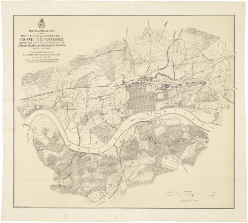
Important Civil War-era maps of Tennessee and Georgia, with unique manuscript additions by a Union officer
J.T. Lloyd / [Major Frank Bakewell James,] Lloyd’s Official Map OF THE STATE OF TENNESSEE [with:] LLOYD’S TOPOGRAPHICAL MAP of GEORGIA. New York, 1862 and 1864, respectively.
Two hand-colored lithographic maps with extensive manuscript annotations by owner Frank Bakewell James
Sold
Out of stock
A pair of scarce Civil War-era maps of Tennessee and Georgia, signed by a Union officer and heavily annotated by him in the field to document his unit’s campaigns, including Sherman’s “March to the Sea.”
Background
Frank Bakewell James (1842-1916) was born in Covington, Kentucky but seems to have spent much of his life in Ohio. He enlisted in the 52nd Ohio Volunteer Infantry as a private in August 1862, was promoted to First Lieutenant in July 1863, and mustered out in June 1865 having achieved the rank of brevet major. He died in Boston, Massachusetts but is buried in Cincinnati.
First mustered in August 1862, the 52nd Ohio was attached to the Army of the Ohio, soon to be renamed the Army of the Cumberland. During the Civil War the unit covered an astonishing amount of ground through Kentucky, Tennessee, Alabama and Georgia before marching north at war’s end to be mustered out in Washington, D.C.—at a conservative estimate easily 3000 miles in all, much of it on foot. The regiment saw action in some of the war’s most important campaigns and battles:
“Organized in August, 1862, under Colonel Dan McCook, it immediately went to the field, operating in Kentucky against the invasion of Bragg. After the battle of Perryville the Regiment performed garrison duty at Nashville until March, 1863; moved into Alabama in September and then to Chickamauga, where it performed good service in that sanguinary battle. It stormed Mission Ridge with Sherman, and followed Bragg’s retreating army to Ringgold; turning again it marched into East Tennessee to the relief of Knoxville. In May the Regiment joined Sherman’s Atlanta campaign and fought at Dalton, Resaca, Peach Tree Creek, Kenesaw Mountain, Atlanta and Jonesboro. At Kenesaw Colonel McCook was mortally wounded. From Atlanta the 52d moved with Sherman to the sea, thence through the Carolinas, and was mustered out at Washington June 3d, 1865.” (Larry Stevens, Ohio in the Civil War)
The maps
Offered here are two large maps of Tennessee and Georgia, both published by commercial mapmaker J.T. Lloyd of New York and bearing the ownership inscription of “Lieut. Frank B. James.” James has heavily annotated each map to indicate the movements of the 52nd Ohio, thus the two maps together provide an almost-complete record of the unit’s location throughout the war.
The line of march is usually outlined in lead pencil traced over in red or blue, often accompanied by directional arrows and with dates given at irregular intervals. This, and the facts that the Georgia map is docketed “June 15th 1864” in James’ own hand and that he held the rank of Lieutenant only through December 1864, indicates that he had these maps with him in the field, annotated them in pencil in the course of his campaigns, and only later traced over his notes in color.
- T. Lloyd, Lloyd’s Official Map OF THE STATE OF TENNESSEE Drawn & Engraved from ACTUAL SURVEYS AND USED BY OUR COMMANDERS. 164 Broadway, New York: J. T. Lloyd, 1862.
Lithograph, 31”h x 46 ¾”w plus margins, wash color by county with outline color to place names as issued. Inscribed in pencil title, “Lieut. Frank B. James, 52d O.V.I.,” with extensive manuscript annotations to map in pencil and black and red ink. Old folds with some creasing, soiling and staining. Minor repairs to losses at fold intersections and margins.
The map depicts Tennessee, almost all of Kentucky and parts of surrounding states. Topographical detail is indicated by hachuring, with much detail provided for waterways, roads, and railroads. The annotations show the movements of the 52nd Ohio, beginning with their departure from Cincinnati on August 23rd, 1862 through the Chattanooga campaign of Fall 1863, as well as a two-month campaign against Hood in northern Alabama in the early Fall of 1864.
- T. Lloyd, LLOYD’S TOPOGRAPHICAL MAP of GEORGIA FROM STATE SURVEYS BEFORE THE WAR… 23 Courtlandt Street, New York and 1 Strand, London, England, 1864.
Lithograph, 36”h x 31 ¼”w plus margins, wash color by county with outline color to places names as issued. Extensive annotations in lead and blue pencil. Inscribed “Lieut Frank B. James 52d O.V.I.” in title and similarly on verso, with added dateline of “Marietta Ga (near) / June 15th 1864.” Old folds and horizontal creases, some soiling and staining. Minor repairs to losses at fold intersections and margins.
The printed map bears similar design and features to the Tennessee map. James’ annotations show the route of the 52nd during the campaign in northern Georgia and the capture of Atlanta and on the “March to the Sea” with Sherman culminating with the capture of Savannah in late December 1864. A long inscription at the top describes the unit’s activities following the Atlanta campaign:
“After capture of Atlanta, division (2d of 14th A.C.) was sent by rail to Florence, Ala. after Wheeler & Forrest’s cavalry, retraced our steps (thus came near being retained by Thomas as part his forces as against Hood’s advance in Nashville), to Chattanooga, March to Savannah, Chattanooga to Galesville, Ala. where joined the Sherman’s Army thro’ Georgia, Galesville to Carterville, Ga on Etowah River starting from RR bridge where our campaign thro’ Georgia began by tearing up rails on Chat’ga & Atlanta RR from the bridge south, left Etowah Bridge Nov 3 ‘64, Atlanta Nov 16, arrived before Savannah Dec 21 ‘64.”
The overall effect of the notations on the two maps is in places bewildering, but with the assistance of even a short history of the 52nd Ohio they quickly come into sharper focus. What is immediately clear however is that the distances covered by James and his comrades are staggering and the number of battles they fought almost overwhelming.
References
Stepenson, Civil War Maps, #129.6 (Georgia) and 389.9 (Tennessee). Rumsey #4817 (Tennessee, 1863 ed.) Neither map in Phillips, Maps of America. Some biographical information was obtained from B.G. Bakewell, The Family Book of Bakewell, Page, Campbell, p. 38.
Inventory ID:


Important Civil War-era maps of Tennessee and Georgia, with unique manuscript additions by a Union officer
J.T. Lloyd / [Major Frank Bakewell James,] Lloyd’s Official Map OF THE STATE OF TENNESSEE [with:] LLOYD’S TOPOGRAPHICAL MAP of GEORGIA. New York, 1862 and 1864, respectively.
Sold
Out of stock
Two hand-colored lithographic maps with extensive manuscript annotations by owner Frank Bakewell James
A pair of scarce Civil War-era maps of Tennessee and Georgia, signed by a Union officer and heavily annotated by him in the field to document his unit’s campaigns, including Sherman’s “March to the Sea.”
Background
Frank Bakewell James (1842-1916) was born in Covington, Kentucky but seems to have spent much of his life in Ohio. He enlisted in the 52nd Ohio Volunteer Infantry as a private in August 1862, was promoted to First Lieutenant in July 1863, and mustered out in June 1865 having achieved the rank of brevet major. He died in Boston, Massachusetts but is buried in Cincinnati.
First mustered in August 1862, the 52nd Ohio was attached to the Army of the Ohio, soon to be renamed the Army of the Cumberland. During the Civil War the unit covered an astonishing amount of ground through Kentucky, Tennessee, Alabama and Georgia before marching north at war’s end to be mustered out in Washington, D.C.—at a conservative estimate easily 3000 miles in all, much of it on foot. The regiment saw action in some of the war’s most important campaigns and battles:
“Organized in August, 1862, under Colonel Dan McCook, it immediately went to the field, operating in Kentucky against the invasion of Bragg. After the battle of Perryville the Regiment performed garrison duty at Nashville until March, 1863; moved into Alabama in September and then to Chickamauga, where it performed good service in that sanguinary battle. It stormed Mission Ridge with Sherman, and followed Bragg’s retreating army to Ringgold; turning again it marched into East Tennessee to the relief of Knoxville. In May the Regiment joined Sherman’s Atlanta campaign and fought at Dalton, Resaca, Peach Tree Creek, Kenesaw Mountain, Atlanta and Jonesboro. At Kenesaw Colonel McCook was mortally wounded. From Atlanta the 52d moved with Sherman to the sea, thence through the Carolinas, and was mustered out at Washington June 3d, 1865.” (Larry Stevens, Ohio in the Civil War)
The maps
Offered here are two large maps of Tennessee and Georgia, both published by commercial mapmaker J.T. Lloyd of New York and bearing the ownership inscription of “Lieut. Frank B. James.” James has heavily annotated each map to indicate the movements of the 52nd Ohio, thus the two maps together provide an almost-complete record of the unit’s location throughout the war.
The line of march is usually outlined in lead pencil traced over in red or blue, often accompanied by directional arrows and with dates given at irregular intervals. This, and the facts that the Georgia map is docketed “June 15th 1864” in James’ own hand and that he held the rank of Lieutenant only through December 1864, indicates that he had these maps with him in the field, annotated them in pencil in the course of his campaigns, and only later traced over his notes in color.
- T. Lloyd, Lloyd’s Official Map OF THE STATE OF TENNESSEE Drawn & Engraved from ACTUAL SURVEYS AND USED BY OUR COMMANDERS. 164 Broadway, New York: J. T. Lloyd, 1862.
Lithograph, 31”h x 46 ¾”w plus margins, wash color by county with outline color to place names as issued. Inscribed in pencil title, “Lieut. Frank B. James, 52d O.V.I.,” with extensive manuscript annotations to map in pencil and black and red ink. Old folds with some creasing, soiling and staining. Minor repairs to losses at fold intersections and margins.
The map depicts Tennessee, almost all of Kentucky and parts of surrounding states. Topographical detail is indicated by hachuring, with much detail provided for waterways, roads, and railroads. The annotations show the movements of the 52nd Ohio, beginning with their departure from Cincinnati on August 23rd, 1862 through the Chattanooga campaign of Fall 1863, as well as a two-month campaign against Hood in northern Alabama in the early Fall of 1864.
- T. Lloyd, LLOYD’S TOPOGRAPHICAL MAP of GEORGIA FROM STATE SURVEYS BEFORE THE WAR… 23 Courtlandt Street, New York and 1 Strand, London, England, 1864.
Lithograph, 36”h x 31 ¼”w plus margins, wash color by county with outline color to places names as issued. Extensive annotations in lead and blue pencil. Inscribed “Lieut Frank B. James 52d O.V.I.” in title and similarly on verso, with added dateline of “Marietta Ga (near) / June 15th 1864.” Old folds and horizontal creases, some soiling and staining. Minor repairs to losses at fold intersections and margins.
The printed map bears similar design and features to the Tennessee map. James’ annotations show the route of the 52nd during the campaign in northern Georgia and the capture of Atlanta and on the “March to the Sea” with Sherman culminating with the capture of Savannah in late December 1864. A long inscription at the top describes the unit’s activities following the Atlanta campaign:
“After capture of Atlanta, division (2d of 14th A.C.) was sent by rail to Florence, Ala. after Wheeler & Forrest’s cavalry, retraced our steps (thus came near being retained by Thomas as part his forces as against Hood’s advance in Nashville), to Chattanooga, March to Savannah, Chattanooga to Galesville, Ala. where joined the Sherman’s Army thro’ Georgia, Galesville to Carterville, Ga on Etowah River starting from RR bridge where our campaign thro’ Georgia began by tearing up rails on Chat’ga & Atlanta RR from the bridge south, left Etowah Bridge Nov 3 ‘64, Atlanta Nov 16, arrived before Savannah Dec 21 ‘64.”
The overall effect of the notations on the two maps is in places bewildering, but with the assistance of even a short history of the 52nd Ohio they quickly come into sharper focus. What is immediately clear however is that the distances covered by James and his comrades are staggering and the number of battles they fought almost overwhelming.
References
Stepenson, Civil War Maps, #129.6 (Georgia) and 389.9 (Tennessee). Rumsey #4817 (Tennessee, 1863 ed.) Neither map in Phillips, Maps of America. Some biographical information was obtained from B.G. Bakewell, The Family Book of Bakewell, Page, Campbell, p. 38.
Additional information
| year published | 1862 |
|---|---|
| event | Civil War |
| publisher | Lloyd, J.T. |
| associations | Lloyd, J.T. |