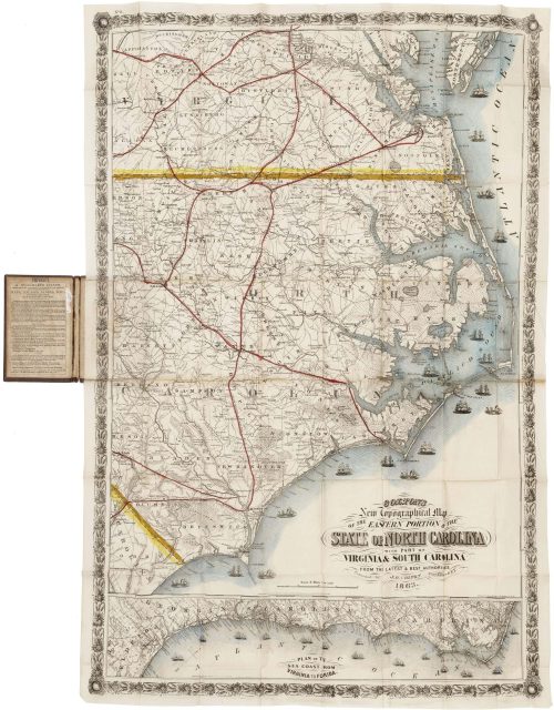
Nebraska during its post-Civil War settlement boom
George F. Cram, Proprietor of the Western Map Depot, CRAM’S SECTIONAL MAP OF NEBRASKA. Chicago: George F. Cram, 1872.
Lithographic pocket map, 28 ½”h x 37 ½”w at neat line plus margins, full wash color by county. Accompanied by, but recently removed from, the original brown cloth pocket folder with blind-stamped ornament and title in gilt on front cover and front pastedown with printed state census data. Map flattened, with scattered foxing, some discoloration along old folds, and some staining in upper margin.
$3,500.00
In stock
A rare and highly detailed map of Nebraska at the outset of the great post-Civil War settlement boom, correcting the notorious “ghost counties” that had plagued earlier maps of the state.
Nebraska had been a state for only five years when this map appeared, and was changing at extraordinary speed. Its population rose from 28,841 in 1860 to 122,993 in 1870, while no fewer than 31 new counties were created between 1870 and 1873. Homesteading was proceeding at a furious pace, with nearly 6,000 claims filed in 1872 alone.[1] Railroads were major agents of settlement, both by providing access to markets and by selling enormous tracts of federally granted land. By 1872 the Union Pacific already crossed the state along the Platte Valley, while the Burlington & Missouri River and other lines were pushing westward from the Missouri, knitting the older settlements of eastern Nebraska to new communities farther west.
Against this background, an up-to-date “sectional” map would have been immensely valuable for settlers, speculators, railroad investors, and other entrepreneurs. Such maps showed the relationship of towns, county lines, rivers, railroads, and other features to the rectangular grid of the federal land survey, divided the public lands into six-mile-square townships, each ordinarily containing 36 “sections” of 640 acres. Cram’s map of Nebraska does not indicate ownership or availability of individual parcels, but it provided a visual means of understanding legal land descriptions and, just as important, the proximity of a tract relative to water, transportation, and markets.
The map depicts Nebraska as well as parts of the adjacent states of Iowa, Kansas, Colorado, and the Dakota Territory. The overall impression is of the east-to-west progress of settlement. Eastern Nebraska is thick with counties, towns, and completed and projected rail routes. Farther west, the routes of the Union Pacific and Burlington & Missouri Railroads form the main corridors of settlement. The Union Pacific dominates the Platte Valley, while the Burlington pushes west from Plattsmouth through Lincoln toward Kearney. Fort Kearny is still shown despite its abandonment as a military post in 1871, while Fort McPherson remained active farther west.
The contrast with western and north-central Nebraska is striking. Here settlements and railroads thin rapidly, leaving immense areas occupied chiefly by rivers, county boundaries and the township grid, and in places very little else.
The map also identifies the Omaha, Otoe, and Pawnee reservations, a reminder of how rapidly the political geography was changing: Congress authorized the sale, with tribal approval, of half the Otoe reservation in 1872, while the Pawnee began their removal to Indian Territory in 1874. Note that the “Cheyenne” label at far left indicates the then-vast Cheyenne County, not a Cheyenne hunting range or reservation.
Of particular interest is Cram’s treatment of Nebraska’s county boundaries. Brian P. Croft has demonstrated that six nonexistent western counties—Lyon, Taylor, Monroe, Harrison, Jackson and Grant—first appeared on maps in the 1860s and were then copied by commercial mapmakers for nearly a decade. Cram himself perpetuated some of these errors on the first edition of his Sectional Map in 1871. Croft specifically singles out this 1872 edition as correcting them, at a time when erroneous counties continued to appear on most competing maps.[2]
The map is very rare. I have been able to locate only one example of an 1871 edition[3], a second of this 1872 edition[4], two of an 1873 edition[5], and one of an 1874 edition.[6] OCLC also records an 1877 “Cram’s New Sectional Map of Nebraska” with the same dimensions, but I have not been able to locate an example for comparison purposes.[7] Other than the present example, there is no record of any edition of the map having appeared on the antiquarian market.
George F. Cram and the Western Map Depot
A native of Lowell, Massachusetts, George Franklin Cram (1841-1928) served, perhaps as a draftsman, in an Illinois regiment during the Civil War and was with the Army of the Cumberland during Sherman’s Georgia Campaign. His wartime correspondence was recently published as Soldiering with Sherman: The Civil War Letters of George F. Cram (DeKalb: Northern Illinois University Press, 2000). The publisher’s blurb is worth quoting:
“Rare among Civil War correspondence, the collection of Union Sergeant George F. Cram’s letters reveals an educated young man’s experiences as part of Sherman’s army. Advancing through the Confederacy with the 105th Illinois Infantry Regiment, Cram engaged in a number of key conflicts, such as Resaca, Peachtree Creek, Kennesaw, and Sherman’s “march to the sea.”
“A highly literate college student who carried a copy of Shakespeare in his knapsack, Cram wrote candid letters that convey insights into the social dimensions of America’s Civil War. With a piercing objectivity, optimism, and a dry sense of humor, Cram conscientiously reported the details of camp life. His vivid depictions of the campaigns throughout Alabama, Georgia, and the Carolinas contribute new insights into the battle scenes and key Union leaders.
“Cram and several of his compatriots adhered to a principled code of personal conduct (no smoking, swearing, drinking, or gambling), striving to maintain integrity and honor in the face of war’s hardships and temptations. Influenced by the abolitionist values of his community and college, Cram’s observations on the effects of slavery and on the poverty of many of the Southerners are especially illuminating.
“Civil War scholars and general readers alike will learn much from Cram’s discoveries and observations–from his sympathy for poor whites to his grudging respect for the Confederates–that reveal the character of a young man maturing at war.”
In 1867 Cram entered a short-lived map-publishing partnership with his uncle Rufus Blanchard in Evanston, Illinois, then in 1869 established George F. Cram & Co. in Chicago. He operated at various Chicago addresses under various names for the next half century, for many years advertising as the Western Map Depot. The business dealt in far more than maps though; per the title block of this Nebraska map, the Depot dealt in “maps, charts, lithographs, steel engravings, photographs, chromos, oval & carved rustic frames &c.”
During the latter decades of the 19th century he published numerous large-scale maps of midwestern and western states, as well as The New Commercial Atlas of the United States (1875), The Standard Atlas of the United States (1880), and Cram’s Unrivaled Family Atlas of the World (1883), the last of which went through many editions well into the 20th century. In 1921 he sold his firm to the National Map Company, which retained the Cram name. In subsequent years the company changed hands more than once, but it continued to operate until 2012, a nearly 150-year run.
References
OCLC 54636670 (this edition, Yale only). Phillips, List of Maps of America, p. 460 (1874 edition).
[1] See William H Beezley, “Homesteading in Nebraska, 1862-1872,” Nebraska History no. 53 (1972), p. 67.
[2] Brian P Croft, “Mapping Nebraska, 1866-1871: County Boundaries, Real and Imagined,” Nebraska History no. 95 (2014): 230-245. Cram’s “Sectional” maps are discussed on pp. 243 and 245.
[3] OCLC 1450388405 (Nebraska State Historical Society).
[4] OCLC 54636670 (Yale).
[5] OCLC 38400162 (University of Houston, Universiteit van Amsterdam).
[6] See Phillips, Maps of America, p. 460.
[7] OCLC 819532864 (University of Texas-Arlington).
Inventory ID:


Nebraska during its post-Civil War settlement boom
George F. Cram, Proprietor of the Western Map Depot, CRAM’S SECTIONAL MAP OF NEBRASKA. Chicago: George F. Cram, 1872.
$3,500.00
In stock
Lithographic pocket map, 28 ½”h x 37 ½”w at neat line plus margins, full wash color by county. Accompanied by, but recently removed from, the original brown cloth pocket folder with blind-stamped ornament and title in gilt on front cover and front pastedown with printed state census data. Map flattened, with scattered foxing, some discoloration along old folds, and some staining in upper margin.
A rare and highly detailed map of Nebraska at the outset of the great post-Civil War settlement boom, correcting the notorious “ghost counties” that had plagued earlier maps of the state.
Nebraska had been a state for only five years when this map appeared, and was changing at extraordinary speed. Its population rose from 28,841 in 1860 to 122,993 in 1870, while no fewer than 31 new counties were created between 1870 and 1873. Homesteading was proceeding at a furious pace, with nearly 6,000 claims filed in 1872 alone.[1] Railroads were major agents of settlement, both by providing access to markets and by selling enormous tracts of federally granted land. By 1872 the Union Pacific already crossed the state along the Platte Valley, while the Burlington & Missouri River and other lines were pushing westward from the Missouri, knitting the older settlements of eastern Nebraska to new communities farther west.
Against this background, an up-to-date “sectional” map would have been immensely valuable for settlers, speculators, railroad investors, and other entrepreneurs. Such maps showed the relationship of towns, county lines, rivers, railroads, and other features to the rectangular grid of the federal land survey, divided the public lands into six-mile-square townships, each ordinarily containing 36 “sections” of 640 acres. Cram’s map of Nebraska does not indicate ownership or availability of individual parcels, but it provided a visual means of understanding legal land descriptions and, just as important, the proximity of a tract relative to water, transportation, and markets.
The map depicts Nebraska as well as parts of the adjacent states of Iowa, Kansas, Colorado, and the Dakota Territory. The overall impression is of the east-to-west progress of settlement. Eastern Nebraska is thick with counties, towns, and completed and projected rail routes. Farther west, the routes of the Union Pacific and Burlington & Missouri Railroads form the main corridors of settlement. The Union Pacific dominates the Platte Valley, while the Burlington pushes west from Plattsmouth through Lincoln toward Kearney. Fort Kearny is still shown despite its abandonment as a military post in 1871, while Fort McPherson remained active farther west.
The contrast with western and north-central Nebraska is striking. Here settlements and railroads thin rapidly, leaving immense areas occupied chiefly by rivers, county boundaries and the township grid, and in places very little else.
The map also identifies the Omaha, Otoe, and Pawnee reservations, a reminder of how rapidly the political geography was changing: Congress authorized the sale, with tribal approval, of half the Otoe reservation in 1872, while the Pawnee began their removal to Indian Territory in 1874. Note that the “Cheyenne” label at far left indicates the then-vast Cheyenne County, not a Cheyenne hunting range or reservation.
Of particular interest is Cram’s treatment of Nebraska’s county boundaries. Brian P. Croft has demonstrated that six nonexistent western counties—Lyon, Taylor, Monroe, Harrison, Jackson and Grant—first appeared on maps in the 1860s and were then copied by commercial mapmakers for nearly a decade. Cram himself perpetuated some of these errors on the first edition of his Sectional Map in 1871. Croft specifically singles out this 1872 edition as correcting them, at a time when erroneous counties continued to appear on most competing maps.[2]
The map is very rare. I have been able to locate only one example of an 1871 edition[3], a second of this 1872 edition[4], two of an 1873 edition[5], and one of an 1874 edition.[6] OCLC also records an 1877 “Cram’s New Sectional Map of Nebraska” with the same dimensions, but I have not been able to locate an example for comparison purposes.[7] Other than the present example, there is no record of any edition of the map having appeared on the antiquarian market.
George F. Cram and the Western Map Depot
A native of Lowell, Massachusetts, George Franklin Cram (1841-1928) served, perhaps as a draftsman, in an Illinois regiment during the Civil War and was with the Army of the Cumberland during Sherman’s Georgia Campaign. His wartime correspondence was recently published as Soldiering with Sherman: The Civil War Letters of George F. Cram (DeKalb: Northern Illinois University Press, 2000). The publisher’s blurb is worth quoting:
“Rare among Civil War correspondence, the collection of Union Sergeant George F. Cram’s letters reveals an educated young man’s experiences as part of Sherman’s army. Advancing through the Confederacy with the 105th Illinois Infantry Regiment, Cram engaged in a number of key conflicts, such as Resaca, Peachtree Creek, Kennesaw, and Sherman’s “march to the sea.”
“A highly literate college student who carried a copy of Shakespeare in his knapsack, Cram wrote candid letters that convey insights into the social dimensions of America’s Civil War. With a piercing objectivity, optimism, and a dry sense of humor, Cram conscientiously reported the details of camp life. His vivid depictions of the campaigns throughout Alabama, Georgia, and the Carolinas contribute new insights into the battle scenes and key Union leaders.
“Cram and several of his compatriots adhered to a principled code of personal conduct (no smoking, swearing, drinking, or gambling), striving to maintain integrity and honor in the face of war’s hardships and temptations. Influenced by the abolitionist values of his community and college, Cram’s observations on the effects of slavery and on the poverty of many of the Southerners are especially illuminating.
“Civil War scholars and general readers alike will learn much from Cram’s discoveries and observations–from his sympathy for poor whites to his grudging respect for the Confederates–that reveal the character of a young man maturing at war.”
In 1867 Cram entered a short-lived map-publishing partnership with his uncle Rufus Blanchard in Evanston, Illinois, then in 1869 established George F. Cram & Co. in Chicago. He operated at various Chicago addresses under various names for the next half century, for many years advertising as the Western Map Depot. The business dealt in far more than maps though; per the title block of this Nebraska map, the Depot dealt in “maps, charts, lithographs, steel engravings, photographs, chromos, oval & carved rustic frames &c.”
During the latter decades of the 19th century he published numerous large-scale maps of midwestern and western states, as well as The New Commercial Atlas of the United States (1875), The Standard Atlas of the United States (1880), and Cram’s Unrivaled Family Atlas of the World (1883), the last of which went through many editions well into the 20th century. In 1921 he sold his firm to the National Map Company, which retained the Cram name. In subsequent years the company changed hands more than once, but it continued to operate until 2012, a nearly 150-year run.
References
OCLC 54636670 (this edition, Yale only). Phillips, List of Maps of America, p. 460 (1874 edition).
[1] See William H Beezley, “Homesteading in Nebraska, 1862-1872,” Nebraska History no. 53 (1972), p. 67.
[2] Brian P Croft, “Mapping Nebraska, 1866-1871: County Boundaries, Real and Imagined,” Nebraska History no. 95 (2014): 230-245. Cram’s “Sectional” maps are discussed on pp. 243 and 245.
[3] OCLC 1450388405 (Nebraska State Historical Society).
[4] OCLC 54636670 (Yale).
[5] OCLC 38400162 (University of Houston, Universiteit van Amsterdam).
[6] See Phillips, Maps of America, p. 460.
[7] OCLC 819532864 (University of Texas-Arlington).
Additional information
| associations | Cram, George F. |
|---|---|
| format | physical |
| year published | 1872 |