1862 Colton map of the United States, colored to highlight the seceded and border slave states
COLTON’S NEW RAILROAD & COUNTY MAP OF THE UNITED STATES THE CANADAS &c. New York: J. H. Colton, 1862.
Case map, 33”h x 39 ½”w at border plus margins, strong original outline and wash color. Printed explanatory label affixed to base of map. Folds to ca. 8 ½”h 5 ¼”w and tipped in to a blue cloth-covered slipcase with printed label of London mapseller G. F. Cruchley. Front endpaper of folder with pasted-on broadside listing Union and Confederate leaders and generals. Ever so slightly toned, a few tiny spots, and minor offsetting at lower right, but about excellent.
$2,250.00
In stock
A striking and scarce 1862 case map of the United States by one of the country’s greatest 19th-century map publishers, with vibrant coloring to highlight the state of the Union early in the Civil War.
This appealing map depicts the United States westward to the Great Plains as well as southern Canada, with the Florida peninsula treated in an inset at far right. When first issued in 1860, Colton had given the map an intricate patchwork color scheme highlighting the state, territorial, and particularly county boundaries across the country. For this Civil War-era edition, Colton greatly simplified the color scheme to delineate the “seceded or Confederate states” (green), “free, or non-slaveholding states” remaining in the Union (red); and, sandwiched uncomfortably between them, the “border slave states” remaining in the Union, though Missouri and Kentucky in particular were badly divided and plagued by violence.
Also worth noting is the ambiguous status of northwestern Virginia, colored yellow as a border slave state but lacking a hard border with Virginia: After Virginia’s secession in April 1861, these mountainous counties, ill-suited to a plantation economy, had in turn voted to secede from Virginia and in 1863 were admitted to the Union as West Virginia.
At finer levels of detail the map offers a great deal of interesting information. It delineates the newly-admitted states of Minnesota (1858) and Kansas (1861) and the eastern half of the enormous new territory of “Dakotah” (1861), but does not name the Nebraska Territory (1854). Three different line styles delineate “rail roads finished”, “proposed R.R.” and “proposed Pacific R.R.”—though oddly the latter appears nowhere on the main map. In the West the routes of several major government expeditions are delineated, as is the Oregon Trail, while U.S. Army forts and outposts are indicated by tiny flags.
An inset map of the United States at lower right adds the states and territories of the West, including a rather misleading depiction of New Mexico as a border slave region, partially occupied by the Confederacy (A Confederate force under General Sibley invaded in April 1862 but by July had retreated back to Texas.) It also shows several routes that in the Antebellum years were under consideration for a trans-continental railroad.
Joseph Hutchins Colton
Colton (1800-1893) was one of the leading American mapmakers and engravers of the second and third quarters of the nineteenth century. His earliest employment was for a sequence of map engraving firms, and he may originally have trained as an engraver before establishing his own business, J. H. Colton & Co., in 1833. Colton focussed on mapmaking and publishing, building the firm up to being the largest in New York.
Although Colton was bankrupted in 1859, when the Bolivian Government defaulted on its substantial debt to him, he bounced back rapidly when the Civil War broke out, as he was well positioned to benefit from the greatly increased demand for maps. Importantly, he focused on practical maps which could be sold in volume, both to the public and the military—maps of the United States, regional maps, topographical maps of individual states showing forts and military installations, as well as more specific maps of the obvious theatres of war.
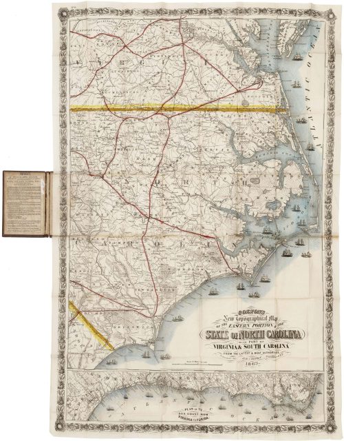
Among the most significant of these Civil war maps are general maps such as “Colton’s United States shewing the military stations, forts, &c” (1861); “J. H. Colton’s topographical map of Virginia, Maryland & eastn. Tennessee & part of adjoining states” (1861); and “Colton’s new topographical map of the eastern portion of the State of North Carolina with part of Virginia & South Carolina from the latest & best authorities” (also 1861). There are also many theatre maps, such as “Colton’s map of the seat of war in Virginia : showing minutely the interesting localities in the vicinity of Richmond” (1862) and “Colton’s plans of U. S. harbors showing the position & vicinities of the most important fortifications on the sea-board and in the interior” (also 1862).
These were just the sort of map sought-after by foreign mapsellers seeking to explain the war to their domestic market. Colton was to dominate this export market, with many of his maps exported to England, such copies often found—as here–with the London mapsellers’ labels pasted-on.
References
Phillips, Maps of America, p. 908 (1860 edition). Rumsey #3358. Stephenson, Civil War Maps, #25.7.
Inventory ID:


1862 Colton map of the United States, colored to highlight the seceded and border slave states
COLTON’S NEW RAILROAD & COUNTY MAP OF THE UNITED STATES THE CANADAS &c. New York: J. H. Colton, 1862.
$2,250.00
In stock
Case map, 33”h x 39 ½”w at border plus margins, strong original outline and wash color. Printed explanatory label affixed to base of map. Folds to ca. 8 ½”h 5 ¼”w and tipped in to a blue cloth-covered slipcase with printed label of London mapseller G. F. Cruchley. Front endpaper of folder with pasted-on broadside listing Union and Confederate leaders and generals. Ever so slightly toned, a few tiny spots, and minor offsetting at lower right, but about excellent.
A striking and scarce 1862 case map of the United States by one of the country’s greatest 19th-century map publishers, with vibrant coloring to highlight the state of the Union early in the Civil War.
This appealing map depicts the United States westward to the Great Plains as well as southern Canada, with the Florida peninsula treated in an inset at far right. When first issued in 1860, Colton had given the map an intricate patchwork color scheme highlighting the state, territorial, and particularly county boundaries across the country. For this Civil War-era edition, Colton greatly simplified the color scheme to delineate the “seceded or Confederate states” (green), “free, or non-slaveholding states” remaining in the Union (red); and, sandwiched uncomfortably between them, the “border slave states” remaining in the Union, though Missouri and Kentucky in particular were badly divided and plagued by violence.
Also worth noting is the ambiguous status of northwestern Virginia, colored yellow as a border slave state but lacking a hard border with Virginia: After Virginia’s secession in April 1861, these mountainous counties, ill-suited to a plantation economy, had in turn voted to secede from Virginia and in 1863 were admitted to the Union as West Virginia.
At finer levels of detail the map offers a great deal of interesting information. It delineates the newly-admitted states of Minnesota (1858) and Kansas (1861) and the eastern half of the enormous new territory of “Dakotah” (1861), but does not name the Nebraska Territory (1854). Three different line styles delineate “rail roads finished”, “proposed R.R.” and “proposed Pacific R.R.”—though oddly the latter appears nowhere on the main map. In the West the routes of several major government expeditions are delineated, as is the Oregon Trail, while U.S. Army forts and outposts are indicated by tiny flags.
An inset map of the United States at lower right adds the states and territories of the West, including a rather misleading depiction of New Mexico as a border slave region, partially occupied by the Confederacy (A Confederate force under General Sibley invaded in April 1862 but by July had retreated back to Texas.) It also shows several routes that in the Antebellum years were under consideration for a trans-continental railroad.
Joseph Hutchins Colton
Colton (1800-1893) was one of the leading American mapmakers and engravers of the second and third quarters of the nineteenth century. His earliest employment was for a sequence of map engraving firms, and he may originally have trained as an engraver before establishing his own business, J. H. Colton & Co., in 1833. Colton focussed on mapmaking and publishing, building the firm up to being the largest in New York.
Although Colton was bankrupted in 1859, when the Bolivian Government defaulted on its substantial debt to him, he bounced back rapidly when the Civil War broke out, as he was well positioned to benefit from the greatly increased demand for maps. Importantly, he focused on practical maps which could be sold in volume, both to the public and the military—maps of the United States, regional maps, topographical maps of individual states showing forts and military installations, as well as more specific maps of the obvious theatres of war.
Among the most significant of these Civil war maps are general maps such as “Colton’s United States shewing the military stations, forts, &c” (1861); “J. H. Colton’s topographical map of Virginia, Maryland & eastn. Tennessee & part of adjoining states” (1861); and “Colton’s new topographical map of the eastern portion of the State of North Carolina with part of Virginia & South Carolina from the latest & best authorities” (also 1861). There are also many theatre maps, such as “Colton’s map of the seat of war in Virginia : showing minutely the interesting localities in the vicinity of Richmond” (1862) and “Colton’s plans of U. S. harbors showing the position & vicinities of the most important fortifications on the sea-board and in the interior” (also 1862).
These were just the sort of map sought-after by foreign mapsellers seeking to explain the war to their domestic market. Colton was to dominate this export market, with many of his maps exported to England, such copies often found—as here–with the London mapsellers’ labels pasted-on.
References
Phillips, Maps of America, p. 908 (1860 edition). Rumsey #3358. Stephenson, Civil War Maps, #25.7.
Additional information
| year published | 1862 |
|---|---|
| event | Civil War |