Skip to content
My Account
Remember Me
Register
Cart
Search for:
Search for:
New Acquisitions
Our Catalog
About
Publications
We Buy Maps
Contact
My Account
Remember Me
Register
Search for:
New Acquisitions
Our Catalog
About
Publications
We Buy Maps
Contact
My Account
Remember Me
Register
New Acquisitions
Our Catalog
About
Publications
We Buy Maps
Contact
Sort by:
Default - newest first
Publication date - newest
Publication date - oldest
Acquisition date - newest
Acquisition date - oldest
Price - lowest
Price - highest
Sort by
Default Order
Sort by
Default Order
Sort by
Name
Sort by
Price
Sort by
Date
Sort by
Popularity
Show
12 Products
Show
12 Products
Show
24 Products
Show
36 Products
French edition of the best Revolutionary War Chart of the Chesapeake… used by the French fleet in the Yorktown campaign?
$
7,500.00
“The best map of Pennsylvania to appear in the 18th century” (Wheat and Brun)
$
17,500.00
John Reid’s “American Atlas,” including the plan of Washington, D.C.
$
20,000.00
William Coffin’s “Map of the Town of Nantucket”
$
35,000.00
William Mitchell’s “Map of the Island of Nantucket”
$
42,500.00
A Western rarity: The first edition of the Nicollet map of the Upper Mississippi River basin
$
7,500.00
A rare and handsome map of Chicago’s first railroad
$
4,500.00
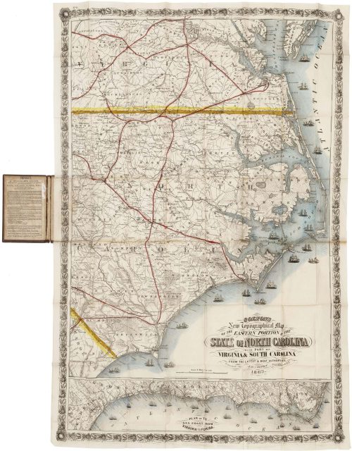
Colton’s spectacular map of North Carolina and the Chesapeake under Union blockade
$
6,000.00
“We come as conquerors, but not as oppressors”: Eisenhower assumes supreme authority in occupied Germany
$
7,500.00
A remarkable synthesis of North American geography, with California as an island
$
7,500.00
Van Keulen’s striking chart of the northern seas, with a delightful ethnographic cartouche
$
1,500.00
Important Revolutionary War-era map of Lake Champlain and Lake George
$
5,000.00
An American take on the “Wheel of Fortune,” with L’Ouverture, Louis XVI, and Napoleon
$
17,500.00
Broadside pitching silk and land speculation in western Pennsylvania, with an optimistic promotional map
$
1,500.00
Nebraska during its post-Civil War settlement boom
$
3,500.00
A hand-drawn pre-invasion intelligence map of Guadalcanal
$
4,500.00
Perhaps the first map of the Internet for popular consumption
$
1,800.00
An American-Japanese venture to conquer the Pacific
$
1,750.00
A late Dutch monument to the exploration of Spitsbergen
$
300.00
George VI descended from Odin, Freya, Aeneas, Priam, and David
$
1,500.00
Timothy Edward Downs maps Windows 95
$
1,500.00
A mammoth 1:5,000 terrain model of Iwo Jima, prepared for the 1945 invasion
$
25,000.00
Rare, early map of the Gulf Coast, printed in reverse!
$
7,500.00
Chesapeake Bay from the English Pilot. The Fourth Book
$
4,000.00
An interesting Doncker chart of the northern seas, with the little-known “Kimmen Line”
$
1,500.00
“The first known publication of the Andrew Ellicott survey of Washington” (Wheat & Brun)
$
17,500.00
“Confidential” U.S. Army map of Okinawa, annotated by a participant in the campaign
$
2,500.00
A beautifully hand-drawn Watch, Quarter, Fire, and Station Bill for an American warship
$
4,500.00
An impressive Antebellum map of the Kansas “Terretory”
$
3,500.00
Wonderfully detailed Civil War-era map of the Hudson River Valley
$
4,500.00
Bellin’s great hydrographic chart of Iceland, prepared for the whale fishery
$
1,500.00
A cornerstone map of Danish St. Croix and its plantation sugar economy
$
17,500.00
Interesting map of the North Atlantic, with “Busjus,” “Friesland,” and more
$
350.00
A fascinating compendium of North Atlantic geography
$
350.00
Off-the-wall broadside for the July 4th, 1860 “Horribles” celebration in Worcester, Mass.
$
1,250.00
Bicentennial-era outsider art, highlighting the best and worst of America
$
9,500.00
1
2
…
9
Next
Page load link